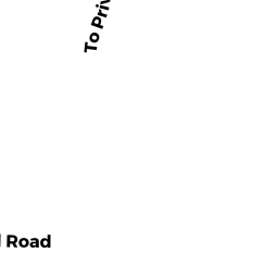
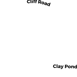
95 CLAY POND RD
Owner Information
MCCALLUM MICHAEL V ETUX
97 CLAY POND RD
BOURNE, MA 02532


Property Details
95 CLAY POND RD is classified as a Undevelopable Residential Land.
95 CLAY POND RD is valued at $6,800. The land is valued at $6,800 and the structures are valued at $0.
This property is in Zone 1. Confirm with local Zoning Board authorities to ensure there are no overlays or other easements on this property.
The most recent deed for 95 CLAY POND RD is recorded at the local registrar in Book 28502, Page 105-7. 95 CLAY POND RD was last sold on Wednesday, November 12, 2014 for $8,700.
Assessment data from fiscal year 2020.
Flood Data
According to the FEMA National Flood Hazard Layer, this property does not appear to be in a flood zone. It may also be in an area not yet reviewed. Nonetheless, confirm this information prior to taking any action.
To view the flood hazards around this property, create a FEMA "Firmette" Map of the area around 95 CLAY POND RD.
Broadband Internet Providers
| Provider | Type | Bandwidth (mbps) | |
|---|---|---|---|
| T-Mobile | Fixed Wireless | 25 | 3 |
| HughesNet | Satellite | 25 | 3 |
| GCI Communication Corp. | Satellite | 0 | 0 |
| Viasat Inc | Satellite | 35 | 3 |
| Verizon New England Inc. | DSL | 5 | 0 |
| Comcast | Cable | 1000 | 35 |
| VSAT Systems, LLC. | Satellite | 2 | 1 |
Broadband service provider data from December 2020.
Adjacent Properties
- 81 ROUNDHOUSE RD
Residential Condominium owned by NEALON MARIE B - 53 ROUNDHOUSE RD
Residential Condominium owned by OMEARA MARTHA H - 65 ROUNDHOUSE RD
Residential Condominium owned by WOODS JANICE - 13 ROUNDHOUSE RD
Residential Condominium owned by PERRY DONNA M - 25 ROUNDHOUSE RD
Residential Condominium owned by CORSINO ANTHONY M & - 34 ROUNDHOUSE RD
Residential Condominium owned by FIELDING BRENDA - 46 ROUNDHOUSE RD
Residential Condominium owned by HANKARD MARGARET T - 1 ROUNDHOUSE RD
Residential Condominium owned by BARONI JAMES M - 2 ROUNDHOUSE RD
Residential Condominium owned by SANGER KAREN E - 3 ROUNDHOUSE RD
Residential Condominium owned by CHENETTE-DAMATO KAREN - 4 ROUNDHOUSE RD
Residential Condominium owned by MARKS JANICE S - 5 ROUNDHOUSE RD
Residential Condominium owned by KIRBY ADELE WINOCOUR TRS - 6 ROUNDHOUSE RD
Residential Condominium owned by SUBY ERIK H - 7 ROUNDHOUSE RD
Residential Condominium owned by DEBETTENCOURT GAIL E - 8 ROUNDHOUSE RD
Residential Condominium owned by SMITH ANN E - 9 ROUNDHOUSE RD
Residential Condominium owned by CONLON MARY M TR - 10 ROUNDHOUSE RD
Residential Condominium owned by KIRBY ADELE WINOCOUR TRS - 11 ROUNDHOUSE RD
Residential Condominium owned by FORDE KENDRA - 12 ROUNDHOUSE RD
Residential Condominium owned by DECICCO KURT & WENDY DECICCO - 14 ROUNDHOUSE RD
Residential Condominium owned by MCCALL ANNE M & - 15 ROUNDHOUSE RD
Residential Condominium owned by MURPHY SANDRA L - 16 ROUNDHOUSE RD
Residential Condominium owned by SHEEDY MELISSA C - 17 ROUNDHOUSE RD
Residential Condominium owned by WILLIAMS CYNTHIA T - 18 ROUNDHOUSE RD
Residential Condominium owned by TSIMORTOS SUSAN - 19 ROUNDHOUSE RD
Residential Condominium owned by BRYANT MARK C - 20 ROUNDHOUSE RD
Residential Condominium owned by WATKINS DANIEL K & - 21 ROUNDHOUSE RD
Residential Condominium owned by BERIO TAMMY L & - 22 ROUNDHOUSE RD
Residential Condominium owned by UZMANN KATHLEEN M - 23 ROUNDHOUSE RD
Residential Condominium owned by FUCHS GEOFFREY W & RHEITA - 24 ROUNDHOUSE RD
Residential Condominium owned by EGAN PAUL A - 26 ROUNDHOUSE RD
Residential Condominium owned by ROBICHAUD ALFRED H - 27 ROUNDHOUSE RD
Residential Condominium owned by MAINA LAWRENCE & - 28 ROUNDHOUSE RD
Residential Condominium owned by KERRIGAN LORI J - 29 ROUNDHOUSE RD
Residential Condominium owned by BAIRD KELLY S - 30 ROUNDHOUSE RD
Residential Condominium owned by JONES PAMELA V - 31 ROUNDHOUSE RD
Residential Condominium owned by FROMM JUNE M - 32 ROUNDHOUSE RD
Residential Condominium owned by MCGONAGLE DONNA - 33 ROUNDHOUSE RD
Residential Condominium owned by AGNES FRANK - 35 ROUNDHOUSE RD
Residential Condominium owned by PETERSON BRUCE A ETUX - 36 ROUNDHOUSE RD
Residential Condominium owned by JOSEPH MICHELLE D & - 37 ROUNDHOUSE RD
Residential Condominium owned by WING WALTER H JR & SUSAN M TRS - 38 ROUNDHOUSE RD
Residential Condominium owned by WHITMORE BARBARA J - 39 ROUNDHOUSE RD
Residential Condominium owned by OCONNELL JOHN P - 40 ROUNDHOUSE RD
Residential Condominium owned by MILNER PETER C ETUX - 41 ROUNDHOUSE RD
Residential Condominium owned by CONWAY ROBERT M - 42 ROUNDHOUSE RD
Residential Condominium owned by HALL KENNETH W ETUX - 43 ROUNDHOUSE RD
Residential Condominium owned by DOHERTY GERALD R - 44 ROUNDHOUSE RD
Residential Condominium owned by GROSSO ROSEMARY - 45 ROUNDHOUSE RD
Residential Condominium owned by MAHONEY JOSEPH F JR & ELAYNE C - 47 ROUNDHOUSE RD
Residential Condominium owned by ROBICHEAU JOSEPH F & - 48 ROUNDHOUSE RD
Residential Condominium owned by MCDONALD RICHARD J - 49 ROUNDHOUSE RD
Residential Condominium owned by CHARETTE MARC T - 50 ROUNDHOUSE RD
Residential Condominium owned by REICHE MARGARET M - 51 ROUNDHOUSE RD
Residential Condominium owned by DICARLI JAMES M & - 52 ROUNDHOUSE RD
Residential Condominium owned by CAVANAUGH RUSSELL D & DONNA M - 54 ROUNDHOUSE RD
Residential Condominium owned by DONOVAN COREY J - 55 ROUNDHOUSE RD
Residential Condominium owned by LANOIE JAMES A - 56 ROUNDHOUSE RD
Residential Condominium owned by CALLAGHAN DANIEL R - 57 ROUNDHOUSE RD
Residential Condominium owned by TOOLAN EDWARD & - 58 ROUNDHOUSE RD
Residential Condominium owned by HEBER JASON & - 59 ROUNDHOUSE RD
Residential Condominium owned by CAREY LEANNA M - 60 ROUNDHOUSE RD
Residential Condominium owned by DEELY CHRISTOPHER J & - 61 ROUNDHOUSE RD
Residential Condominium owned by DINEEN HEATHER - 62 ROUNDHOUSE RD
Residential Condominium owned by LAVENDER MICHAEL L & - 63 ROUNDHOUSE RD
Residential Condominium owned by PALAZZOLO JENNIFER M - 64 ROUNDHOUSE RD
Residential Condominium owned by TARLOW PHYLLIS S & MICHAEL J - 66 ROUNDHOUSE RD
Residential Condominium owned by LEMIEUX PAUL F ETUX - 67 ROUNDHOUSE RD
Residential Condominium owned by MOLNER GEORGE - 68 ROUNDHOUSE RD
Residential Condominium owned by HEIGHT DONALD R JR - 69 ROUNDHOUSE RD
Residential Condominium owned by PARKER BRUCE E - 70 ROUNDHOUSE RD
Residential Condominium owned by DUNN PAULA JANZ - 71 ROUNDHOUSE RD
Residential Condominium owned by VORONOV ALEXANDRE A - 72 ROUNDHOUSE RD
Residential Condominium owned by BILLINGSGATE ASSOCIATES LLC - 73 ROUNDHOUSE RD
Residential Condominium owned by KLEIN RENA J - 74 ROUNDHOUSE RD
Residential Condominium owned by DUARTE THERESA MARY - 75 ROUNDHOUSE RD
Residential Condominium owned by ZEIGLER SARA - 76 ROUNDHOUSE RD
Residential Condominium owned by FOGARTY BETH A - 77 ROUNDHOUSE RD
Residential Condominium owned by CONLEY JAMES J JR - 78 ROUNDHOUSE RD
Residential Condominium owned by BONE WENDY - 79 ROUNDHOUSE RD
Residential Condominium owned by CIAMPA KEITH & - 80 ROUNDHOUSE RD
Residential Condominium owned by VAUGHN JILL TRUSTEE - 82 ROUNDHOUSE RD
Residential Condominium owned by MARA THOMAS F ETUX - 83 ROUNDHOUSE RD
Residential Condominium owned by MILLER DANIEL A &LYNN E CORMAY - 84 ROUNDHOUSE RD
Residential Condominium owned by SHERMAN CARL S & - 85 ROUNDHOUSE RD
Residential Condominium owned by CLAPP PETER - 0 ROUNDHOUSE RD
Residential Condominium owned by SEA WATCH VILLAGE CONDOMINIUM - 97 CLAY POND RD
Single Family Residential owned by MCCALLUM MICHAEL - 91 CLAY POND RD
Single Family Residential owned by BARDSLEY BRUCE &